Back to Home
Route Planning on Real Terrain
Reinforcement learning agent that finds low-slope routes on real terrain around the Misti volcano.
The Challenge
Finding a walkable route on steep terrain is usually solved with fixed rules. We wanted an agent that learns the route by itself from elevation data, and we wanted to measure how close it gets to the optimal path.
Our Solution
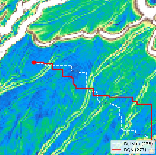
We turned the Copernicus DEM (Digital Elevation Model) GLO-30 of the Misti volcano in Arequipa into a grid environment where steep slopes are penalized. We trained Q-learning, DQN (Deep Q-Network), Double DQN and REINFORCE agents in PyTorch and compared them with Dijkstra.
Key Results
- DQN reaches a fixed goal in 100% of test runs
- Routes only 7.1% more costly than the optimal Dijkstra path
- DQN beats REINFORCE: 100% vs 95% success
Project Info
Client
Cloud4Geo experiment, ready to adapt to your organization
Services
Reinforcement Learning, Terrain Analysis
Year
2026
Interested in similar results?
Let's discuss how we can apply these solutions to your project.
Contact Us